Everyone has different preferences, goals and attitudes about hiking and climbing mountains. I'd like to get your thoughts on a handful of topics. Please take a few minutes to complete this short, 5-question survey.
Thank you!
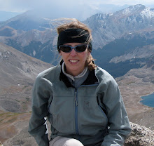
Sarah
July 28, 2009
TrueSummit Survey
July 24, 2009
Crestones - One Down, One to Go
Last weekend we started our run of the final fourteeners on our list with a backpack into South Colony Lakes and an attempt at the Crestones.
The Peak was a great climb, with the exception of a large group above us who sent a near-continuous (and totally unnecessary) volley of rockfall down on all the climbers below them. Here's a view of the route from part-way up the Red Gully:

By the time we re-climbed Broken Hand Pass it was too late to attempt the Needle. We were also out of water and beat. We'll be back in September to take care of that unfinished business.
Skipping the Needle left us with enough energy to rise at 3:00 a.m. on Sunday and shoot up Humboldt in the dark, arriving on the summit just before sunrise:

We were back at the tent around 7:00, on the trail before 8:00, and enjoying a couple IPAs at the car by 10:30.
Missing the Needle shouldn't derail our plans of finishing this year, but we don't have much room for error. Our remaining peak list / itinerary looks like this:
- Snowmass (this weekend)
- Pyramid
- Culebra
- Blanca / Ellingwood
- Little Bear
- Maroon Peak
- El Diente
- Sunlight / Windom / Eolus
- Wilson Peak / Mt. Wilson
- Capitol
- North Maroon
- Crestone Needle
- Sneffels
No place for a nervous person.
The only peak that truly concerns me is Little Bear. Having no personal control over rocks shooting down at my head is a frightening prospect. The others I think I can handle, but it will be a true test of physical and psychological fortitude.
Here's a parting shot of the Needle... see you in September:

July 14, 2009
Trailhead Access - The Good, the Bad, and The Lake Como Road
Whoever said that getting there is half the fun has never taken a white-knuckle drive down one of Colorado’s mountain roads.
Accessing fourteener trailheads can be problematic, to put it mildly. Many of the standard routes begin at the end of 4WD roads, some of which are exceedingly rough and not passable with your standard Explorer or Pathfinder.
Which is why I’m proud to say I’ve climbed all of my 14ers so far with a lowly Honda Civic.
Using a car with pitifully low clearance has probably added close to 100 miles to my total hiking distance, but I’ve decided that fuel efficiency outweighs the extra foot travel. Plus, road-walking builds character!
I’m living proof that you don’t need an SUV to climb the fourteeners. But I’d be amiss if I didn’t warn you that not having 4WD will make for longer hikes.
The roughest road in Colorado (probably in the entire US, for that matter) is Lake Como Road, which leads to Blanca, Ellingwood and Little Bear. It's so rough you'd have to be crazy to take any sort of motorized vehicle up it.... not that it stops people from trying:

On the other hand, some 4WD roads go so far up the mountain that you can barely call the remaining route a climb. For example, the road on Mt. Antero tops out at over 13K. And you can drive a 4x4 up to 12,700' on Castle Peak.
When planning a hike, be sure to consider whether your vehicle can safely make it up the road to wherever you intend to start. You can check trailhead conditions on 14ers.com. When in doubt, allow extra time for potential road walking.
Finally, while I’m determined to finish the fourteeners with my trusty Civic and refuse to accept rides as a matter of principle, you can take comfort in the fact that it’s fairly easy to bum a ride in some kind soul’s FJ Cruiser if you want to cut down your distance.
July 13, 2009
Mountaineering Safety - Avoiding Accident & Injury on the Peaks
Climbing mountains is not a risk-free activity. Just this past weekend, a climber from Colorado Springs was killed on Capitol Peak, a 14er near Aspen.
Tragic accidents like these happen every year. You can sift through an extensive history of Colorado mountaineering accidents on listsofjohn.
If you’re going to climb, you must be willing to accept some level of risk. But that doesn’t mean you shouldn’t take every possible precaution to keep yourself safe.
I can’t cover every aspect of mountaineering safety in one post. Instead, I’ll cover some of the main hazards, give a few tips on how to avoid them, and point you to more extensive resources.
Avalanches – Snow can remain on the high peaks well into June, with some areas holding snow year-round. Avalanche danger is always a risk, particularly in spring and early summer.
Some tips:
- Add the Colorado Avalanche Information Center (CAIC) to your bookmarks. The site provides backcountry avalanche condition forecasts, updated twice daily.
- Take an avalanche awareness course. Most REI stores offer several class throughout the year. Find one near you on REI's online store locator and click on Classes, Events and Presentations for a schedule.
- If you venture out in winter or spring, carry avalanche gear: beacon, shovel and probe. (Note that this equipment is useless unless your partner has the same gear.)
Getting Lost – The easier fourteeners have well-defined trails, and you’ll have plenty of people to follow if you’re hiking on a summer weekend. But many of the harder peaks require good route-finding skills.
Some tips:
- Always carry a map and compass (and know how to use them). A GPS can be helpful, but isn’t a replacement for map-and-compass orienteering.
- In case you do get lost and are forced to spend a night out, carry emergency food, matches and extra clothing. A lightweight bivy sack like this one is also a good idea.
Rock Fall – Many of the more difficult fourteeners have loose rock. Not only do you want to avoid being hit, you also need to avoid sending rocks down on climbers below you.
Some tips:
- Wear a helmet.
- Climb routes that are known for rock-fall during the week.
Lightning – Refer to my July 8 post on The Art of the Alpine Start.
I’ve already recommended Freedom of the Hills, but I’ll plug it again here as a must-have resource. Reading this book will give you the knowledge you need to travel safely in the mountains, but remember that there’s no substitute for actual experience.
July 8, 2009
The Art of the Alpine Start
I'll be the first to admit that I'm not a morning person. But I've come to accept the fact that my peak-bagging habit requires me to rise early on the weekends.
The practice of departing for a climb before dawn or at first light is known as getting an "alpine start." As unpleasant as it may seem, hitting the trail very early is the only way to avoid afternoon thunderstorms.
Thunderstorms are simply a fact of life in the high country, particularly in the summer months.
For a good overview of weather patterns in the high country, check out the "Consider the Weather" section in this article on the Colorado Fourteeners Initiative (CFI) website. It explains that the storms we experience in Colorado from June through September are caused by rising warm air masses and can bring heavy rain, hail, and lightning.
No one likes to get caught in the rain or hail. But the real danger is lightning.
According to the National Weather Service (NWS), lightning has killed an average of 58 people per year during the past 30 years – more than either tornadoes or hurricanes.
This page on the NWS website offers tips on avoiding thunderstorms and treating lightning strike victims. Key takeaway: Seek shelter!
Choose your start time depending on the distance of your hike (also taking into consideration your average speed on the trail). The standard rule of thumb is to be off the summit by noon. However, in my experience, it's best to be back below treeline by noon.
It's very easy to get "summit fever" and push on when you know the weather is rolling in. I've done it myself, on the Atlantic-Pacific-Crystal trifecta of top 100 peaks.
The black clouds looming overhead in the photo below turned into an electrical storm that literally had my hair standing on end. I made it down safely, but not without taking far too great a risk.

July 6, 2009
Difficulty Ratings - Choosing Your First Fourteener
Now that you know what to eat, drink and carry, it's time to make the big decision: Which peak to try first? You’ll obviously want to start with one of the easier fourteeners, but keep in mind that “easy” is a relative term here. All of Colorado’s highest peaks are physically demanding, but the technical difficulty of their standard routes varies dramatically. Difficulty Ratings The most commonly used rating system for climbers is the Yosemite Decimal System (YDS), which identifies five “classes” that range from walking a trail to scaling a sheer rock face. The following article on outdoorswithdave.com provides a good overview of the YDS: Class 1: Walking, on an established trail. Class 2: Hiking, up a steep incline, possibly using your hands for balance. Class 3: Climbing up a steep hillside; a rope is not normally used. Class 4: Exposed climbing, following a ledge system for example. A rope would be used to belay past places where a fall could be lethal. Class 5: This is where technical rock climbing begins. I agree with most of these assessments, but can offer a bit more detail based on my experience. Class 2 is often used to describe a route without a defined trail. You might be hiking over talus (large pieces of broken rock) or scree (smaller pieces of broken rock). Here is an example of class 2 terrain on Antero: To me, class 3 involves a lot more than “climbing up a steep hillside.” The class 3 routes I’ve done (Longs, Wetterhorn, Lindsey) required me to use my hands for a good portion of the route. Foot- and hand-holds were easy to locate, but it wouldn’t have been possible to simply “walk” up. Here is an example of class 3 terrain on Longs: I’ve only had a tiny taste of class 4 so far. In my limited experience, the main difference between class 3 and 4 is the availability of holds. The consequences of a fall on class 4 terrain would also generally be greater than on class 3, but the exposure and relative danger of a climb isn’t necessarily correlated to its class rating. However, contrary to the outdoorswithdave article, most people don't use rope on class 4. So when you’re choosing your first fourteener, look for class 1 or 2 routes and shorter hikes with less elevation gain. In my opinion, Bierstadt, Sherman and Quandary are the easiest. To see how all of the fourteeners stack up, check out this guide on 14ers.com. 

4th of July Double - Mt. Lindsey + Huerfano Peak
This past weekend I had a little lesson in mountaineering safety, which complements my other post today on difficulty ratings.
The standard route on Mt. Lindsey is rated 2+ and involves climbing up a scree-filled gully that holds snow until mid-summer. We climbed the peak on Saturday after hiking up Forest Road 580 Friday night (our Civic couldn't make it up) and setting up camp.
Rather than take the loose gully and flirt with the rotten band of snow in the middle of it, we skirted to the right and found a more solid class 3 route, as shown in this photo:

The safety lesson was learned by observing other climbers. Even though Mt. Lindsey is notoriously loose and steep, the other four people we encountered on the mountain were not wearing helmets.
I strongly recommend a climbing helmet for any route with rock-fall potential, and for any climb rated class 3 or above. This is an $80-$100 purchase that could save your life!
We also managed to tag Huerfano Peak, a Centennial 13er just 0.6 mile from Lindsey. The extra summit made for a 13-hour day (including the 6-mile backpack out), but was well worth it.
On a final note, I have to admit that I failed to heed my own advice on adequate hydration. I ran out of water on the summit of Huerfano. The next four miles and 4,400 feet of elevation loss were brutal, as I fantasized about an ice cold glass of tart lemonade.
Another lesson learned: Take 10 minutes to filter more water!
-Sarah
July 1, 2009
Hydration - The Best Cure for Altitude Sickness
Now that you know what to eat, let’s talk about what to drink on a fourteener hike.
This one’s easy: Water. Lots of it. Mix in a little Gatorade powder if you like, just keep the fluids coming.
In my essential gear post, I suggested using a hydration bladder. I’ll reiterate that here – drinking from a hose that’s easily within reach is far easier than fumbling for a water bottle.
How much water is enough? It varies depending on the temperature, the distance you’re hiking and your own physical needs. A good baseline for an “average” fourteener route (6-8 miles, 3,500 feet of vertical) is two liters.
Acute Mountain Sickness
Hydration is important in any physical activity, but it’s critical at elevation. That’s especially true if you’re coming from sea level.
Acute Mountain Sickness (AMS) is a very real possibility at 14,000 feet. Many people actually get it at much lower elevations.
According to the Institute for Altitude Medicine (IFAM), AMS “feels exactly like a bad hangover.” Nausea, headache and fatigue are the most common symptoms. This page on IFAM’s website offers more information on the causes, prevention and treatment of AMS.
Adequate hydration can be an effective way to prevent AMS. Sleeping at 6,000 feet or higher the night before a climb can also help. However, once the symptoms set in, the only real cure is to descend to lower elevation as quickly as possible.
Subscribe to:
Posts (Atom)